Fort Lauderdale neighborhood orientation
A factual map of the cores residents live in: Las Olas, Flagler Village, Victoria Park, Sailboat Bend, Sistrunk, the beach barrier island, downtown, Tarpon River, and the airport/port edge.
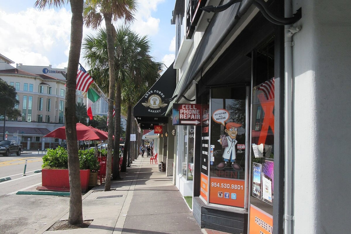
Las Olas usually means the corridor along Las Olas Boulevard from downtown toward the Intracoastal, including the restaurant/retail corridor and nearby Isles. The downtown core sits around Broward Boulevard, Andrews Avenue, Federal Highway, the New River, and the FEC/Brightline corridor. Practical realities include metered parking, bridge openings, Riverwalk event traffic, and proximity to NSU Art Museum, Main Library, Broward Center, MODS, and Stranahan House.
- Key spines: Las Olas Boulevard, Andrews Avenue, Federal Highway
- Transit/rail: Brightline and downtown shuttle/water routes
- Traffic issue: Las Olas bridge openings
Flagler Village sits north of downtown around the former warehouse and rail corridor between Broward and Sunrise, with Federal Highway on the east and the FEC/Flagler corridor on the west. It is now a dense mix of apartments, creative districts, MASS District/FAT Village programming, and active redevelopment. Use the Flagler Village Civic Association and city maps for current boundaries.
- General area: Broward to Sunrise
- Known for: apartment growth, arts districts, redevelopment
- Source: civic association and city maps
Victoria Park runs east of Federal Highway toward the Intracoastal/Middle River area, with single-family homes, multifamily pockets, and quick access to Las Olas, Holiday Park, and the beach. It is also a Fortify Lauderdale stormwater reference neighborhood, so flood-resilience updates belong in any current neighborhood refresh.
- Source: Victoria Park Civic Association
- Nearby anchors: Holiday Park, Las Olas, beach access
- Watch: stormwater project status
Sailboat Bend is the historic neighborhood west of the downtown core near the south side of the New River and the Broward Center edge. Tarpon River sits south and west of downtown around the Tarpon River/New River geography, with Hardy Park and Southside Cultural Arts Center as key public anchors. Both read as close-in residential neighborhoods shaped by river access, older housing stock, and downtown spillover.
- Sailboat Bend: historic district west of downtown
- Tarpon River: close-in residential area around river geography
- Watch: Fortify Lauderdale and neighborhood association updates
The Sistrunk corridor is Fort Lauderdale's historic Black business and civic corridor and sits inside the Northwest-Progresso-Flagler Heights CRA. Anchors include the LA Lee YMCA/Mizell Community Center, African American Research Library and Cultural Center, Old Dillard Museum, and CRA-backed redevelopment. Current housing and infrastructure claims need fresh verification because the corridor is actively changing.
- CRA area: Northwest-Progresso-Flagler Heights
- Anchors: LA Lee YMCA/Mizell, AARLCC, Old Dillard
- Watch: affordable housing, infrastructure, and CRA incentives
The beach barrier island includes Central Beach, Las Olas Oceanside Park, Hugh Taylor Birch State Park, and the A1A corridor. Bridge openings, beach parking, major events, and tourism traffic shape daily life. The airport and Port Everglades edge affects residents through cruise traffic, runway activity, SE 17th Street congestion, and FLL advisories. Fort Lauderdale Executive Airport in the north has separate noise-abatement channels.
- Barrier island: A1A, Birch Park, beach parks
- Port/Airport edge: SE 17th Street, I-595, FLL, Port Everglades
- FXE: northern general aviation airport and noise hotline